You are here
Remote groundwater monitoring
In the framework of the Flemish contributions to the LifeWatch infrastructure, a remote groundwater monitoring network was initiated to monitor groundwater fluctuations on locations with difficult access (such as military domains and floodplains).
Research
Fluctuations in groundwater levels are a determining factor for the survival of (protected) plant populations. The INBO monitors these through WATINA, a monitoring network of over 9000 groundwater wells in Natura 2000 areas in Flanders. Measurements are typically taken manually in the field, which is labour intensive and accessibility dependent. The INBO already experimented with devices that monitor and log groundwater levels automatically, but hardware failures or external factors such as vandalism can still result in loss of months of data.
Infrastructure
In the framework of LifeWatch, INBO has extended its monitoring techniques since 2013 by using devices that log and transmit groundwater levels in real-time without the need for any manual intervention and thereby reduce the risk of data loss. These GPRS loggers use an internal modem and a SIM card to send the data over the mobile network and are deployed in inaccessible areas with specific issues such as military domains or flood plains distributed across Flanders.
The infrastructure is being used in several projects that need real-time groundwater data, for example to detect (acute) droughts in protected areas. The aim is to design an early-warning monitoring network for locations where the groundwater level is not only measured frequently, but where the results are also made available quickly. This allows researchers to make well-founded decisions per water basin in the event of severe drought.
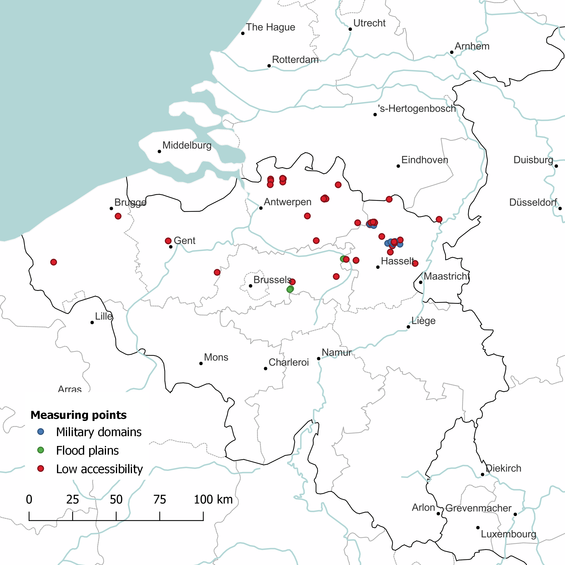
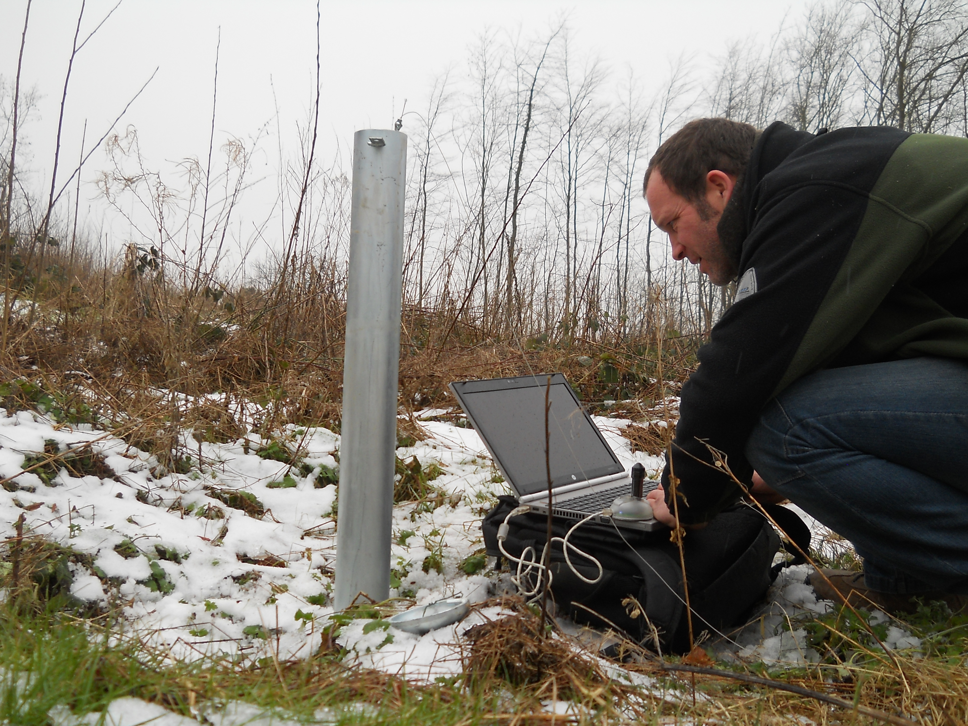
Left: Map with the location of the WATINA measuring points with GPRS functionality. (©INBO) - Right: Groundwater well in the WATINA monitoring network (©INBO)
Data
Data are collected in a central database managed by the manufacturer (Eijkelkamp) from which they are automatically exported and stored in the WATINA database managed by INBO. Since November 2018, validated data from the WATINA database are published to DOV (‘databank ondergrond Vlaanderen’), a web platform that aggregates soil, subsoil and groundwater data in Flanders (mainly) used by policy makers and consultancy agencies. Via an automated pipeline, WATINA data (including those from GPRS loggers installed under LifeWatch) are made available to all users. As such, the scope of the data publication is much larger and the integration with the other data providers enables users to query and retrieve data from the different partners at the same time, leading to an improved user experience and increased efficiency.
The web application provides interactive and human-readable extraction and querying of the data, but in order to enable machine-based extraction and conversion of the data the open source Python package (pydov) was developed. This package aims to support the integration of DOV data in larger data processing pipelines, the reproducibility and/or repeatability of research studies, and the integration of data in third-party applications.