You are here
Climate monitoring research infrastructure (KLIVEG)
In the framework of the Flemish contributions to the LifeWatch infrastructure, a monitoring network has been established to measure meteorological and hydrological variables such as soil moisture and groundwater levels.
Research
Climate change and the increasing frequency of extreme weather events such as heat waves, drought, intense precipitation and flooding have important implications on the biodiversity and ecosystem services of vegetation. Long-term monitoring of groundwater levels, soil moisture and meteorological variables (such as temperature, precipitation and wind) can help explain the observed changes in vegetation types and plant phenology and give insight into future patterns.
The Research Institute for Nature and Forest (INBO) has been involved in climate monitoring projects and networks in forests in the worldwide ILTER network (International Long-Term Ecological Research) in the past decades. In 2017, the KLIVEG project was launched in the framework of LifeWatch in order to extend the existing network in forest to open vegetation types. A monitoring network has been established to measure meteorological variables (temperature, precipitation, wind,...) and the environmental variables such as soil moisture and groundwater levels using standardized protocols. These long-term monitoring results are useful in studies of e.g., plant phenology. In order to connect with ongoing research and abiotic monitoring initiatives, 5 study sites in the LTER network (Long-Term Ecosystem Research network) were equipped with sensors. Each of the selected sites contains mainly open habitats and the plots were put in vulnerable Natura 2000 vegetation to link climate monitoring with the performance of these internationally protected vegetation types. The following LTER-sites were selected: Westhoek coastal dunes, Bos ‘t Ename, Doode Bemde, Valley of the Zwarte beek and National Park Hoge Kempen.
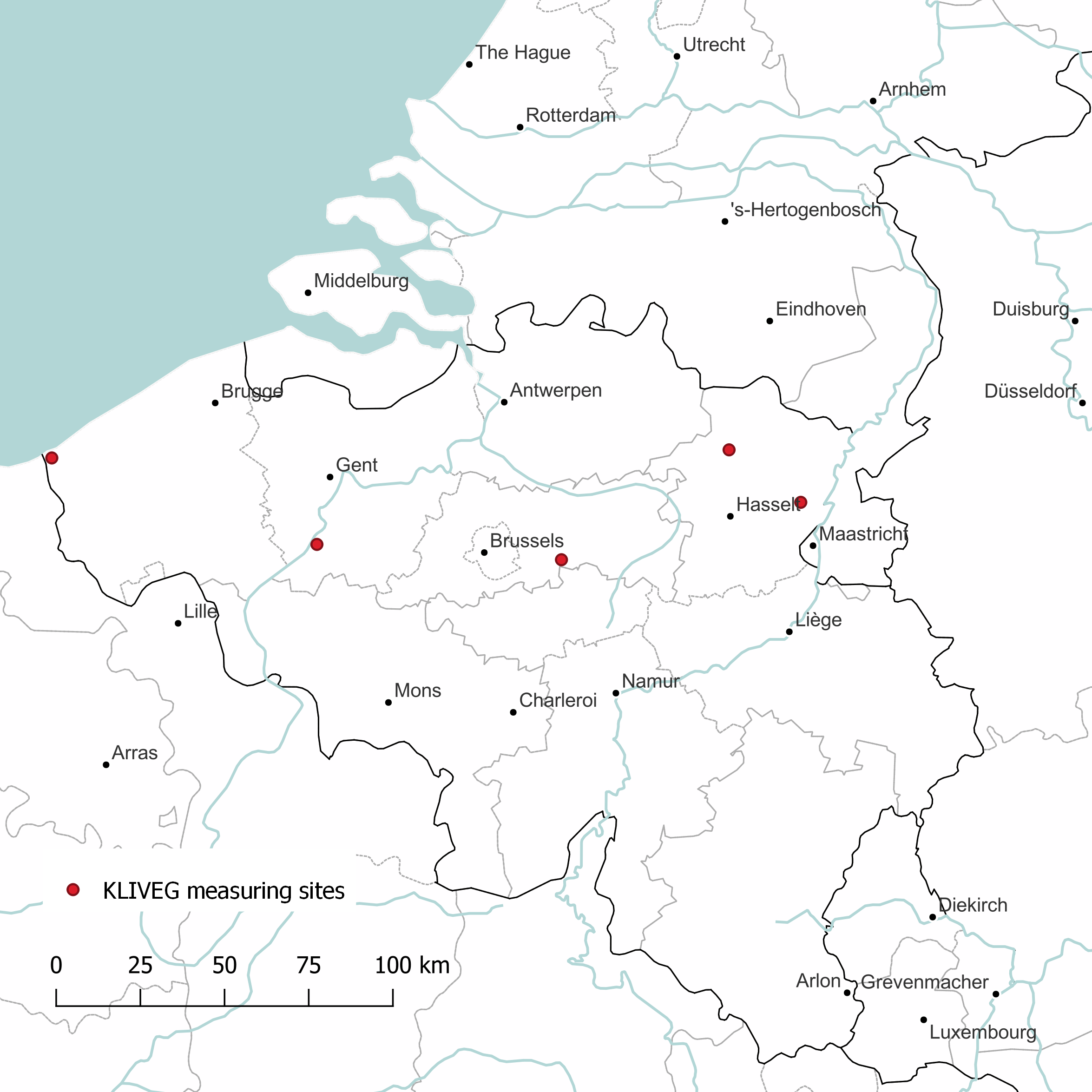
Map with the location of the KLIVEG measuring sites.
Infrastructure
5 study sites in the LTER network have been equipped with groundwater and soil moisture sensors, weather stations and data loggers. The field set-up consists of three plots per study site. A fully equipped measurement site contains:
- Groundwater sensors (3 per site, 1 in each plot)
- Data loggers powered by solar panels (3 per site, 1 in each plot)
- A weather station (1 per site)
- Soil moisture sensors installed at 4 different depths (in each plot, with a total of 12 (3 x 4) per site)
When installing the soil moisture sensors, a soil profile pit was dug for a detailed description of the soil profiles. Soil samples were taken from the different depths in order for further analysis and to calibrate the soil moisture sensors in the lab.

Scheme of the technical set-up at the KLIVEG sites. At each site, measurements are conducted at 3 plots (left). Plot 1 contains 1 weather station, 1 data logger, 1 GPRS modem, 1 groundwater sensor and 4 soil moisture sensors (middle), while plots 2 and 3 are similar except for the absence of a weather station (right).
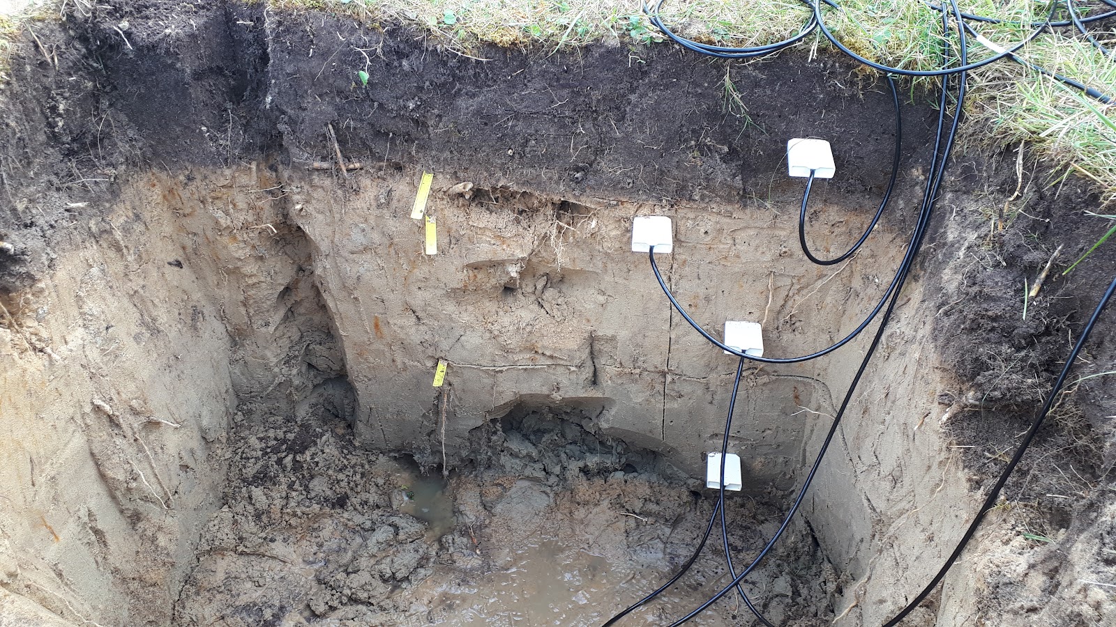
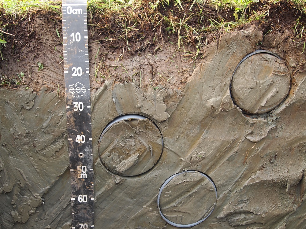
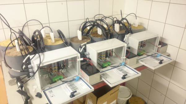

Top left: Soil profile pit with the installation of soil moisture sensors at 4 different depths in plot 1 in the Westhoek coastal dunes. (©INBO) - Top right: iCollection of soil samples at different depths the Doode Bemde for the calibration of the soil moisture sensors in the lab. (©INBO) - Bottom left: Lab calibration of the soil moisture sensors. (©INBO) - Bottom right: View of a closed soil profile pit with a solar powered data logger (left) and a groundwater monitoring well (right) at the Doode Bemde (©INBO).
Data
In order to send the collected data automatically to the INBO's Amazon S3 storage cloud, each data logger is connected with a GPRS modem. The modems are able to accomplish two-way communication which enables the possibility to change the measuring protocol of the sensors remotely.